When I tell people I am a graduate student at a marine lab they often ask me about what type of sea creatures I get to work with. I then have to do my best to explain what I actually do without them completely losing interest in my research. I will now attempt to do the same with you. Spoiler alert – I don’t work with any type of sea creature, or even the sea at all. I study lakes, specifically Lake Mattamuskeet, a big, beautiful, weird, tragic, lake in the coastal plain of NC.

Google maps image of Lake Mattamuskeet
Despite what some people say, (looking at you North Carolina Aquarium) Mattamuskeet is the largest natural lake in North Carolina*. There are places along the bank where you can look out and see only water stretching out in front of you. There are also places where you can look out and see the highway that cuts across the middle of the lake. In the 1940s construction of highway 94 extended right into the lake, no bridges, just sand and pavement right onto the lake bed. This rather unusual choice was likely made because the lake is only about one meter deep, on average. If it were allowed, you could swim out into the middle of one of the halves of the lake, and stand up. I say “if it were allowed” because there is no swimming in the lake. Even if it were allowed you would be immersing yourself in yellowish brown water full of silt and grass carp.
This wasn’t always the case. Before 2014 the west side of the lake was dark and turbid but the east side was clear and full of lovely benthic vegetation. In 2014, suddenly, and for reasons not yet fully understood, the water in the east basin flipped, and is now as turbid as the west. This all happened despite culverts cutting beneath the highway hydrologically connecting the east and west basins. So why was the water in the west half of the lake turbid while the east half was clear? How did it persist like this despite being connected? What happened in 2014 to cause the water in the east basin to mirror the west, and how did it happen so fast? These are some of the questions I (along with many many many others) are attempting to answer. One question that doesn’t take hours of field work and puzzling over data to answer is, why does it matter? Who cares if this big but shallow lake in the middle of nowhere North Carolina is now somewhat reminiscent of lentil soup?
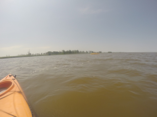
Image taken Summer 2017 in the east side of the lake
Shallow lakes are the most common type of lake on the planet, but are some of the least studied. They break a lot of rules of traditional limnological thinking, but provide many of the same ecosystem services of their larger, better studied, counterparts. Lake Taihu, for example, is a huge shallow lake in eastern China that is relied on for drinking water. In recent years, parts of this lake have had harmful algal blooms. Mattamuskeet is visited every year by thousands of migratory waterfowl, which rely in part on benthic vegetation for food. This vegetation has all but disappeared and waterfowl hunting is a large source of revenue to the area.
Starting an in depth examination of an ecosystem after it’s collapse is not ideal, but it is necessary. Mattamuskeet might hold important information about the factors that push water quality in shallow lakes from good to poor and what can be done about it. Pilot level studies started at multiple institutions are looking at the feasibility of different restoration techniques. I recently conducted a planting experiment to see how transplanted benthic vegetation would fare in turbid conditions, and measure the impact of herbivory on their survival. So, although my main interaction with cute sea creatures are pictures I see on twitter, I do get to do some pretty cool work that will hopefully have a positive impact on the future of shallow lake ecosystems.
*by surface area.
